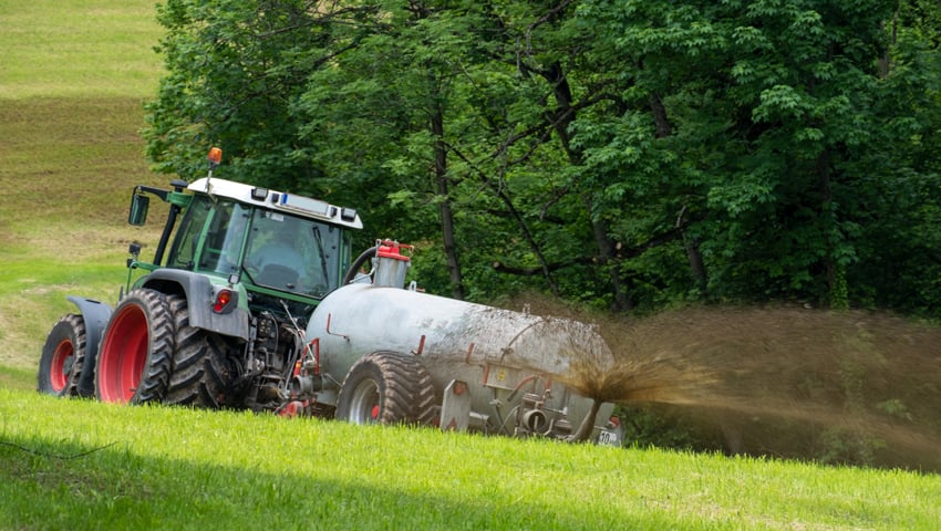
Farmers in Wales, including on the River Usk, and in Scotland on the River Nith, are trialling an app that enables farmers make informed slurry spreading decisions and reduce nutrient leeching.
The Tywydd Tywi Weather app provides live information for farmers including rainfall, soil temperature, soil moisture content, wind speed and air temperature.
The app is an initiative of The Agriculture Research Centre (ARC) based at Coleg Sir Gâr in Wales.
Weather stations have been strategically placed on farms within a catchment, and all farms in the catchment are able to relate to the data capture and recommendations.
The trials are taking place over four river catchments in South Wales (each Special Areas of Conservation) and with four First Milk farmers on the River Nith in south-west Scotland.
The data is gathered by telemetry to a central database to be analysed and displayed via a portal and phone app.
The front-end data is displayed very simply in the form of a traffic light format.
Informing policy
The Tywydd Tywi Weather project is designed to rekindle interest, discussion and interaction between the regulator and the landowners.
Currently, there is closed period of several months for slurry spreading during the winter, but this policy was put in place before recent advances in data collection and handling.
The app is being used to research whether a more dynamic system – which ‘green lights’ spreading when the weather and ground conditions allow – could be used instead. This would avoid the rush to empty stores before and after the closed period.
Farmers using the app are also encouraged to have an up to date nutrient management plan that will identify high, medium and low-risk areas on the farm as regards the application of nutrients. The app guidance can be easily captured and recorded by the farmer as a record of how they based their decision making.
App development
Explaining the purpose and development of the app, independent consultant, Chris Duller, said, “When you start talking about the movement of nutrients and the risks involved in nutrient losses there’s an awful lot of things to think about. It was a case of trying to devise an app that wasn’t overly complicated but had the right parameters that we needed to measure in order to get an accurate and sensible picture.
“It gives you your soil conditions, your weather forecast and all the parameters that will likely affect the risks of either nutrient loss or conditions that might affect spray drift – it’s all in one place.
“Within the app one of the important things we’re measuring is soil temperature, which is key to nutrient uptake. The decisions we take about when we go with nitrogen applications or slurry applications are all about trying to get as much of that nitrogen into grass as possible.
“Within the app we’ve got a traffic light system, so on a warm, sunny day there’s obviously no risk so everything on the app is nice and green, but as soon as we get into areas where the soil moisture starts to increase then any rainfall is going to be more likely to run off the top. So if I got 5 or 6mm of rain today, then not a problem, but if I got 5 or 6mm of rain when the soil is already pretty saturated then it creates conditions of run-off, particularly on sloping ground, and it raises the risks of areas close to water courses.
“The app will always give you a snap shot looking forward – I’m not just interested in what it’s going to do today – I want to know what the weather forecast is for tomorrow and the day after. So all the loss period really is that 48-72 hours, rather than just what’s going on today.”