Researchers are to develop enhanced methods for capturing uncertainties in flood hazard maps, to support targeted protection against the effects of climate change.
A £1.2 million, three-year initiative will seek to curb the time and cost involved in running computer models of projected flooding to the year 2100, while enabling detailed assessment of a wider range of scenarios than currently possible.
This will aid the creation of flood adaptation measures – such as warning systems, physical methods, and land planning – matched to the needs of different parts of the UK.
Professor Lindsay Beevers from University of Edinburgh said, “UKRI’s support has enabled us to develop an understanding of how to use models to address uncertainties inherent in both flood and drought prediction. This is crucial to modelling flooding events successfully, especially in view of both the multiplicity and the cascading nature of their direct and indirect impacts. We want to encourage a new approach and fresh mindset capable of meeting the challenges of flood adaptation across the UK in the decades ahead.
The project, led by Universities of Edinburgh and Bristol and the UK Centre for Ecology and Hydrology, will seek to develop current models used to project future changes to flood inundations, which use historic data of river flows and water levels.
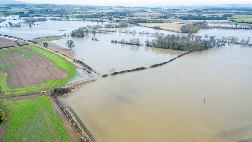
Computer models play a key role in informing the design of flood adaptation measures. By highlighting how rain and river flows work their way through urban and rural landscapes, they make it possible to evaluate the extent of potential flood inundation caused by extreme weather events.
However, they can often take a long time to run, and many simulations are necessary to understand the potential futures, experts say.
Advanced algorithms
The research aims to develop new algorithms which enable flood models to run faster, making it practical and affordable to conduct runs with multiple parameters.
It will also integrate best-available climate change projections, and dovetail regional and local-scale modelling, boosting understanding of risks.
The measures will seek to help manage the risk of river, coastal, surface water and other flooding, which represent a threat to road, rail, electricity, health and other infrastructure, and millions of people.
The project is supported by the UKRI Engineering and Physical Sciences Research Council (EPSRC) and Natural Environment Research Council (NERC).
The Environment Agency, the Scottish Environment Protection Agency (SEPA), Arup, Fathom and Kaya Consulting are partners in the initiative.
Professor Charlotte Deane, Executive Chair of the Engineering and Physical Sciences Research Council, said, “As the climate changes, the UK needs practical responses to the growing threat of flooding. This new project will help deliver affordable, accessible, usable modelling tools that enable government and industry to work together to achieve better flood protection sustainably and cost-effectively.”