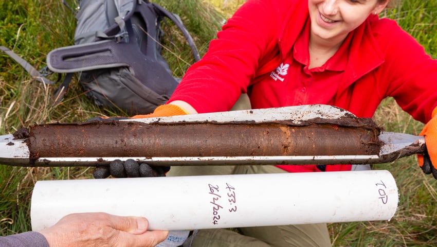
Peatland experts, working with the National Trust at Marsden Moor in West Yorkshire, have found that the moor’s peat stores at least one million tonnes of carbon, further evidence that peatlands can play a crucial role in tackling climate change.
Best known as a popular spot for tourists and walkers in West Yorkshire, and sandwiched between the conurbations of Leeds and Manchester, this 2,300-hectare moorland (5,683 acres) has provided weekend fresh air for generations of mill and office workers.
Now there is evidence that these windswept uplands hold between 1 to 1.5 million tonnes of carbon in their ‘millennia-old’ peat, highlighting the vital role that healthy blanket bogs play in the tackling the climate emergency. It also shows the importance of preserving and restoring the moorlands, to prevent vast amounts of carbon from being released into the atmosphere.
The carbon estimate was obtained by a team of researchers from the School of Geography at the University of Leeds, led by palaeoecologist Dr Antony Blundell, working together with nine dedicated community volunteers and Rangers from the National Trust to carry out an assessment of peat depths and stratigraphy (the make-up of different layers of peat which were created over time).
Across more than 100 days over a four-year period, the team measured the depth of the peat at 2,290 set locations across the entire Marsden Moor estate – covering nearly every hectare of the windswept moorlands.
This research provided an accurate estimate of the total amount of peat across the estate – around 21 million cubic tonnes – allowing the team to calculate the amount of carbon stored as between 1 and 1.5 million tonnes.
Dr Antony Blundell, a senior researcher into peatlands at the University of Leeds, said, “A good carbon storage estimate is extremely important as it can illustrate the value of these moorlands and their role in mitigating climate change. The work of the volunteers has allowed us to gather much more data than we would normally have available – so we expect a really robust estimate of carbon storage to be derived from this project.”
As well as revealing the capacity of the peat for holding carbon, the team has been able to learn a lot more detail about how the peatlands were formed and their current condition. Through some initial radiocarbon dating, they have confirmed that the peat started to form locally in some areas as early as 10,000 years ago and then spread from Mesolithic times, ‘blanketing’ the landscape.
Dr Blundell explained, “Peat on average forms at up to 1mm per year, and the deepest areas of peat discovered were over five metres deep. In some locations, some depths showed evidence of Stone Age fires while other sites at other depths had evidence of ancient trees including pine and birch, and others again showed partially degraded vegetation.
“From these preliminary findings, we can begin to create a database of peat quality and constituents linked to the vegetation across the estate, which should be unique in the UK.”
“Peat is like a book – once you can read it, you can understand the history of a place and how you might restore it.”
