This article, by Samakshi Tiwari, first appeared on Forest News
Mangrove forests span around 147,000 square kilometres, or about one per cent of global land area. They harbour unique biodiversity, prevent soil erosion, provide for livelihoods and are one of the most efficient natural systems for carbon capture and storage on Earth.
Yet these critical ecosystems are under threat from rising sea levels, natural disasters, and anthropogenic pressures: 10,400 square kilometres of mangroves were lost between 1990 and 2020, and the downward trend continues to this day.
Asia contains the highest proportion of mangroves globally, with Indonesia alone holding about 30 per cent of all such forest on the planet. The Sundarbans, a saltwater swamp spread across India and Bangladesh, takes the prize for the most extensive contiguous patch of mangrove forest, stretching over about 10,000 square kilometres.
However, this bioregion sits in an area of particularly rapid sea level rise, and anthropogenic degradation continues, too. More data is urgently required to gauge what needs to happen for these forests to survive. That’s why researchers at the Centre for International Forestry Research and World Agroforestry (CIFOR-ICRAF) began a study in January this year to strengthen ecological monitoring and management for Sundarbans mangroves.
An historic bioregion at risk
Alongside 24 mangrove species, the Sundarbans hold significant biodiversity in terms of fauna, including more than 250 species of fish, over 300 species of birds, and a number of endangered mammals such as the Irrawaddy Dolphin (Orcaella brevirostris), the Ganges River Dolphin (Platanista gangetica), and the Royal Bengal Tiger (Panthera tigris tigris).
The Sundarbans have provided important resources to people since the Mauryan age (400-200 BC), and its ecosystem services are estimated at USD 7 billion. In recognition of its significant contribution to the economy and society, the area has been legally protected to various degrees for over a century, and has received increased attention after being designated a UNESCO World Heritage site in 1987. Under this management structure, it has designated core, buffer, and transition zones which are protected to different degrees, allowing for local livelihood activities such as fishing and collecting honey to continue in some areas.
However, while direct tree felling is prohibited within the Sundarbans, it has lost 58 square kilometres of mangroves in its core area and 52 square kilometres in the buffer area from 2000 to 2020, due to anthropogenic pressures as well as erosion and inundation.
Information gaps in a challenging field
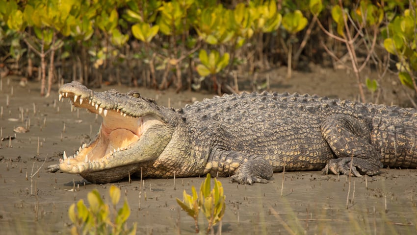
To protect what remains, we need a better understanding of the causes and extent of decline in mangrove cover and the overall health of the Sundarbans. Existing studies rely on satellite imagery to understand land-use change over time, but most such analyses are not ground-truthed due to the region’s remoteness and inaccessibility, and the presence of dangerous wildlife such as saltwater crocodiles (Crocodylus porosus) and Bengal tigers.
The ecosystem also traverses an international border, making it difficult to obtain necessary permissions easily. What’s more, navigating the area’s dendritic creeks by boat requires tight coordination among researchers and boat drivers to align with the fluctuations in tides and water levels.
Despite these challenges, on-ground data remains critical to capture the information required to understand the impacts of rising sea levels on sediment dynamics, shifting salinity, and other changes to the equilibrium of the system. This data can help improve estimates of changes and assist in refining existing models and predictions on the region’s growing vulnerability to flooding and submergence, and the loss of coastal habitat for wildlife and humans.
A promising start
In response to this need, CIFOR-ICRAF initiated a study in January 2024, with support from the West Bengal Forest Department and local research institutions. It seeks, among other things, to establish a network of ecological monitoring stations where long-term data can be collected for better characterisation of an appropriate systemic response to the multiple pressures on the ecosystem.
First, the team identified 19 sites for installing Rod Surface Elevation Tables (rSETs) to measure the sedimentation rates across the Sundarbans delta. We also installed automated sensors to measure salinity and groundwater fluctuations in the mangrove zones at high temporal resolution for extended periods. This in-situ data will help to understand which areas of the reserve are most threatened by sea level rise and the changing hydrologic balance of the region.
Our movement within the Sundarbans Biosphere Reserve was limited due to tigers and crocodiles, as well as wet and cold weather conditions on some days. Each forest camp office was fenced so that tigers could not enter the area: the forest staff and boat crew often joked that in the Sundarbans it is humans that are in cages, whilst tigers roam freely.
The installation of rSETs represents the beginning of a long-term ecological monitoring effort, whereby the team will check the devices at regular intervals to determine sedimentation or erosion rates, while also capturing other parameters to determine overall mangrove ecosystem health.
In the future, the team plans to estimate above- and below-ground carbon stocks of the mangroves, using Sustainable Wetlands Adaptation and Mitigation Program (SWAMP) protocol to measure vegetation structure and total ecosystem carbon stocks. This information will be useful for prioritising sites for additional conservation measures and other adequate management interventions based on how different zones within the reserve are responding to stressors and drivers of change. Given the challenges inherent in monitoring in this environment, it’s hoped that once such monitoring is in place, it can serve as a template for developing monitoring strategies across similar landscapes within the country.
Life on the edge
The planet’s mangroves, though adaptable, are currently ‘living on the edge’ themselves. Their response to climate change in different geographic regions will depend on relative sea level rise, availability of sediments and freshwater through river discharge, fluctuations in ground elevation, and more.
Conservation interventions, and recognition of the ecosystem services these forests play, are critical parts of the solution. India has seen a marginal increase in mangrove cover in recent years due to both natural regeneration and planting, while the Sundarbans has gained 81 square kilometres of mangrove cover in its transition zone from 2000 to 2020.
Now, concerted efforts to understand ecological changes, and effective planning and actions to stabilise the landscape are required to protect mangrove ecosystems from further damage. Investing more time and resources in field-based scientific approaches to understand the root causes of threats is a key piece of the puzzle for preserving mangroves more effectively, so they can continue providing myriad services to humanity – as they have done for millennia.